The Conversation (0)
Sign Up
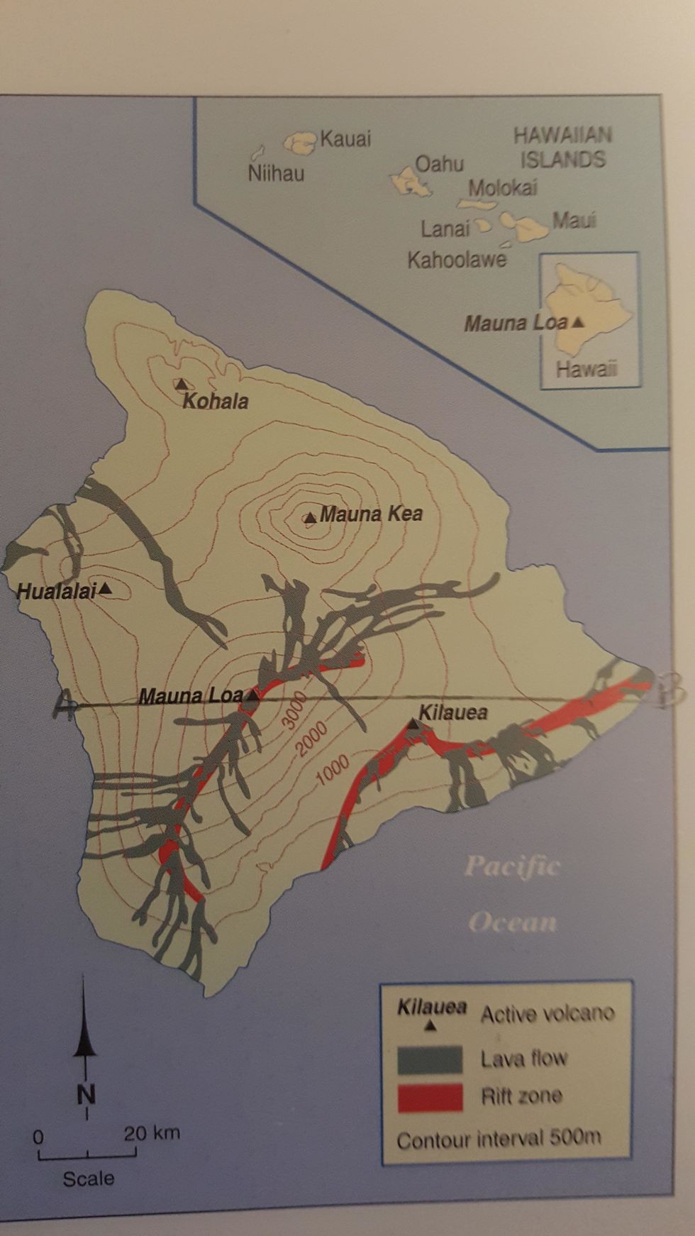
Draw a line between two points (A & B) across your map
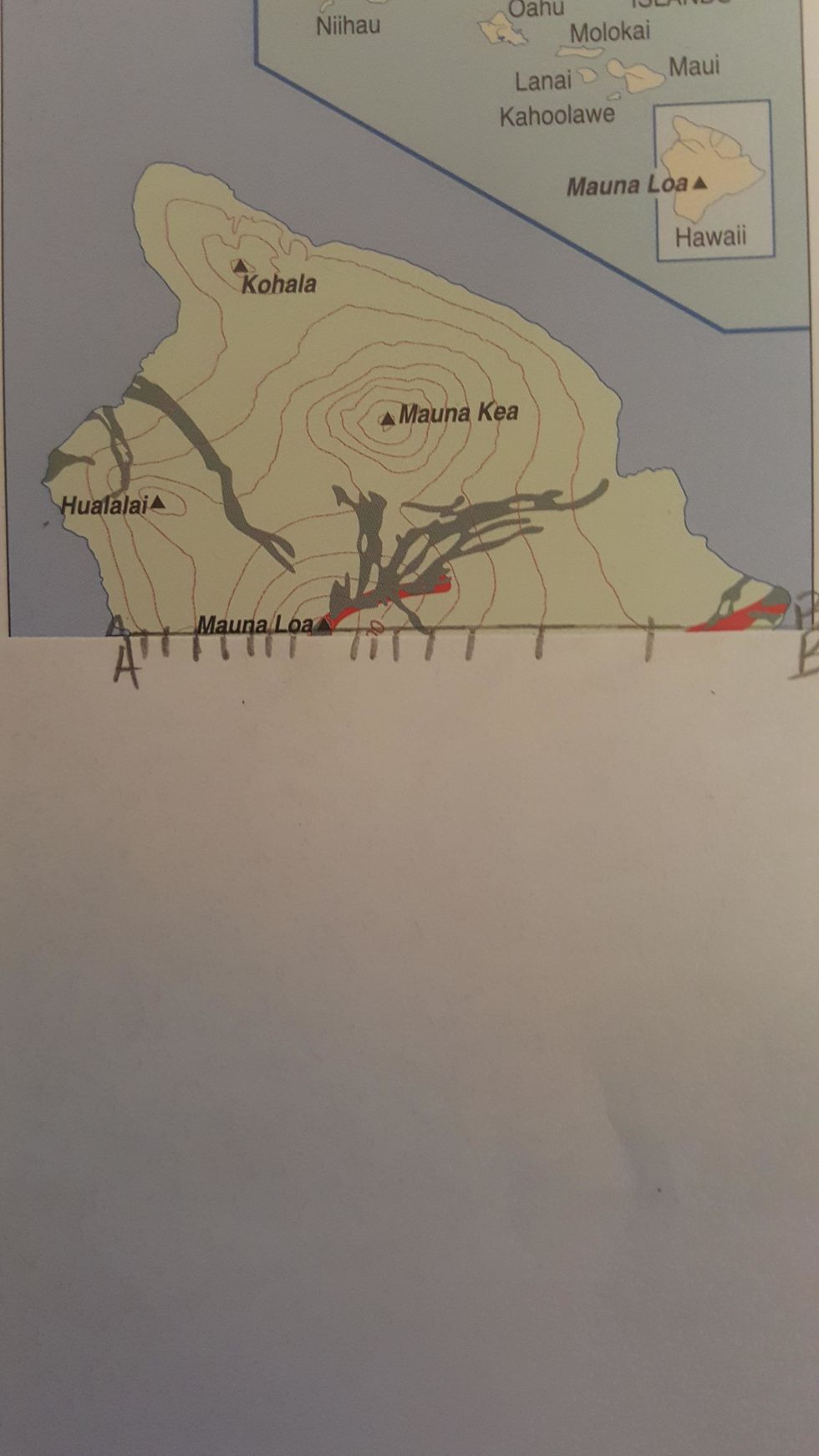
On the edge of your blank sheet of paper mark where the contour lines intersect with the line between point A and B.
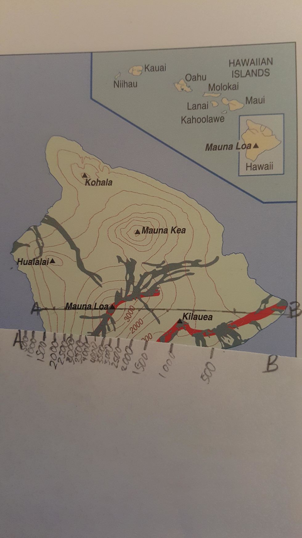
Use the map to label the height of each contour line you have marked
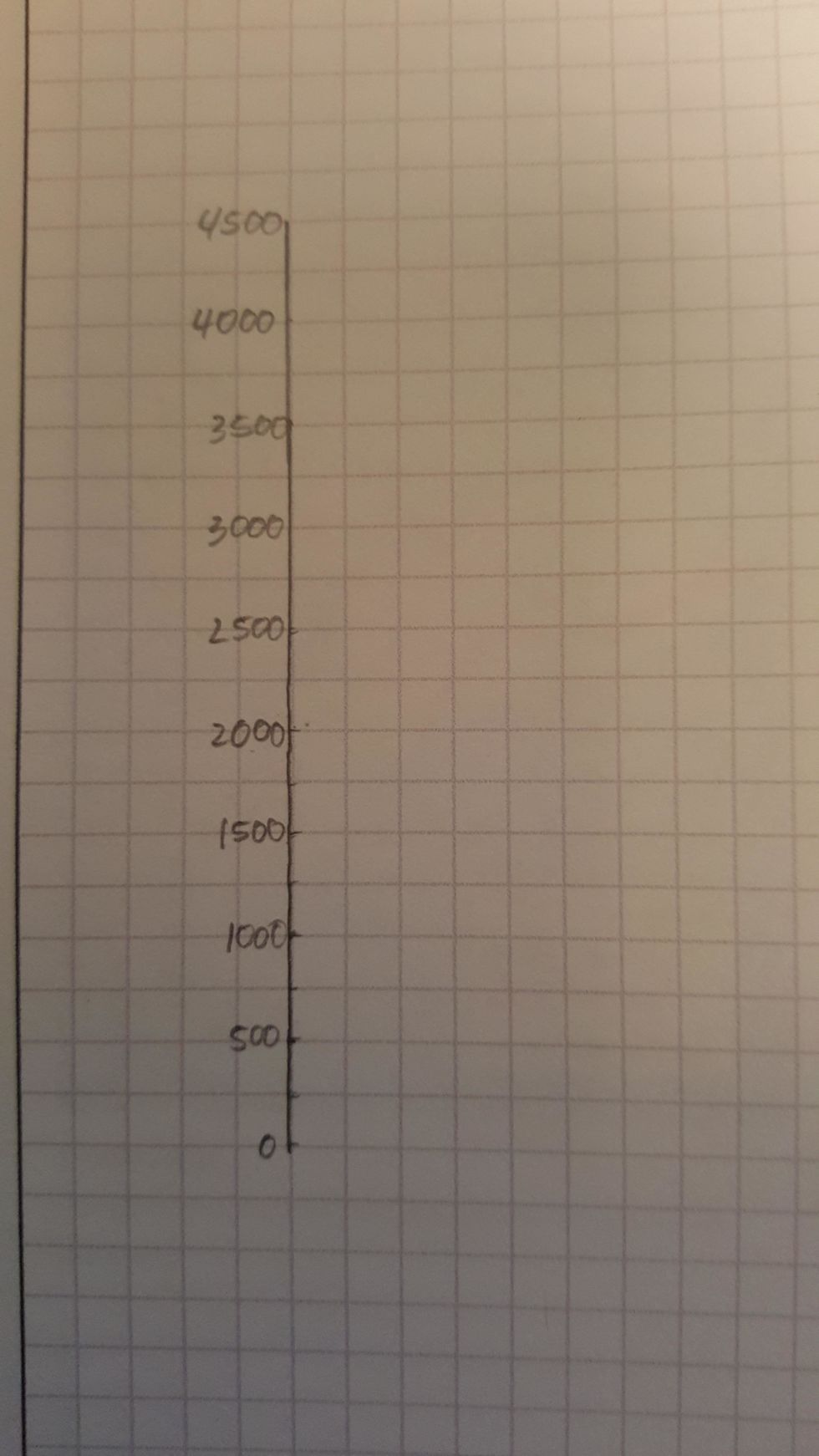
Draw a y-axis on your graph paper that represents height intervals of the contour lines.
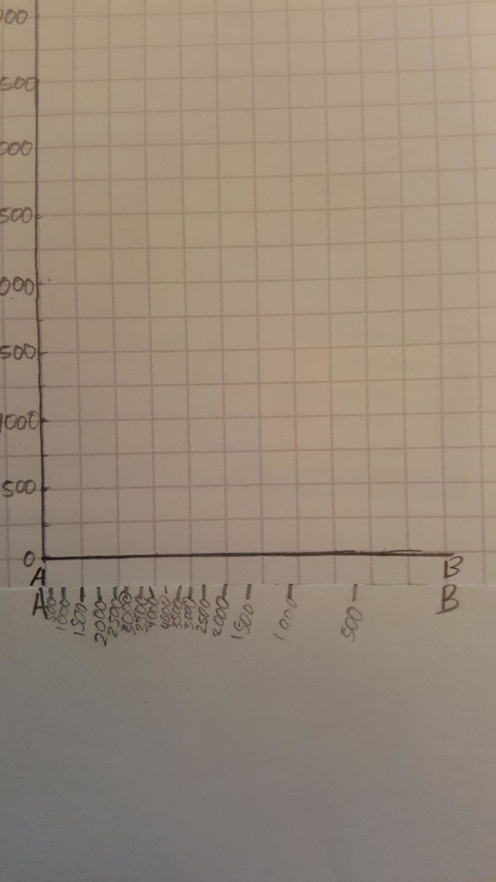
Use the edge the blank piece of paper to draw the x-axis. It should be the same size as you original line on the map.
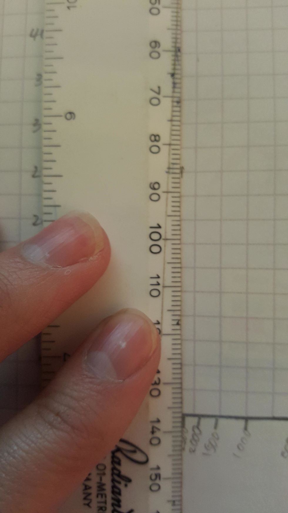
Use a ruler to mark the contour lines against the y-axis from the edge of the blank piece of paper.
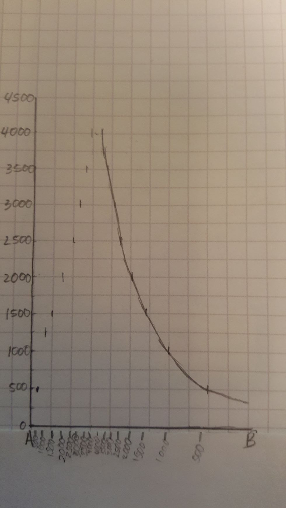
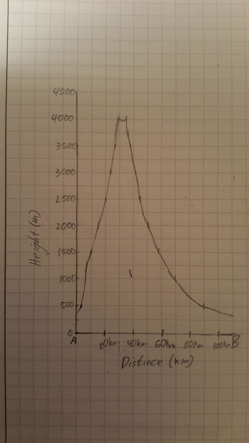
Make sure your x and y axis is accurately labelled
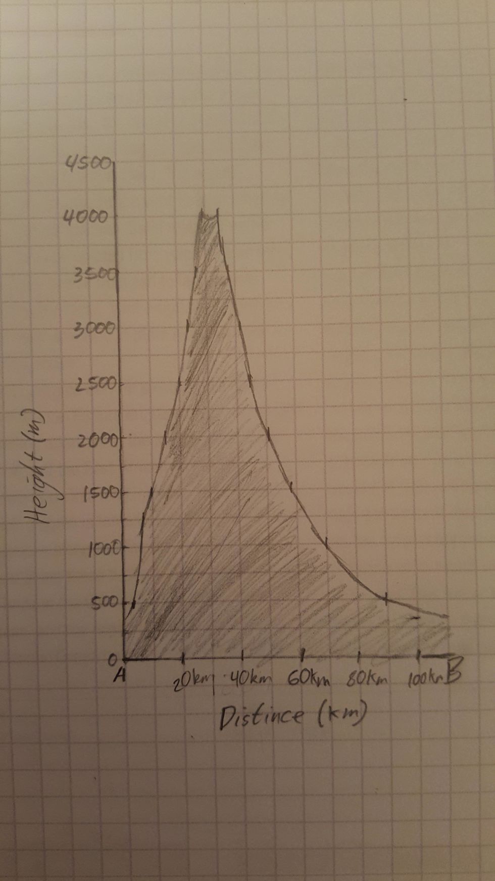
Shade in your Landform to complete the Cross-section
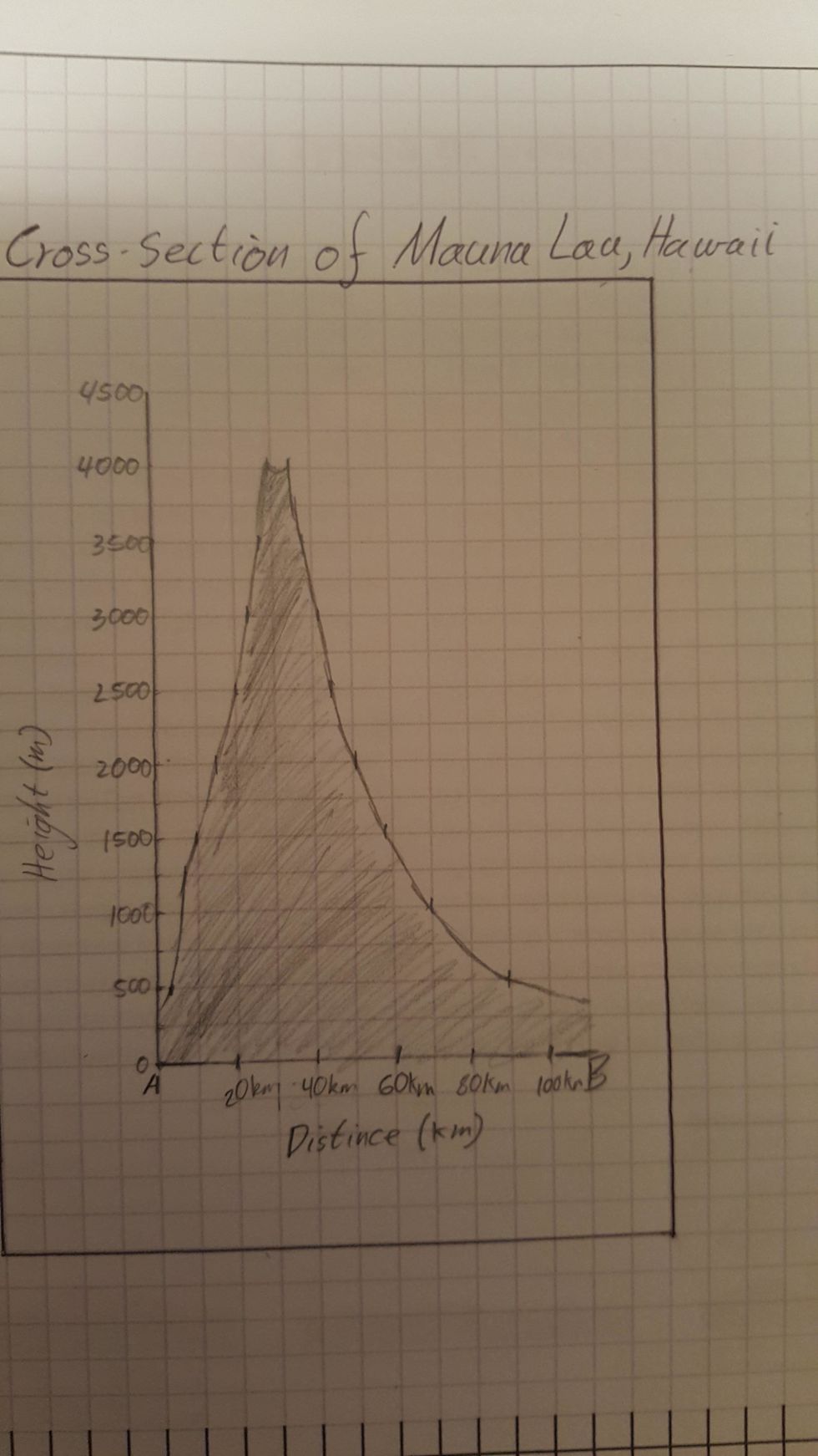
Make sure you have followed the BALTSS conventions by including a Border, title and source.